

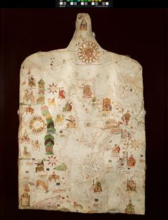
Physical description: On parchment (single skin). 102 x 640 mm.
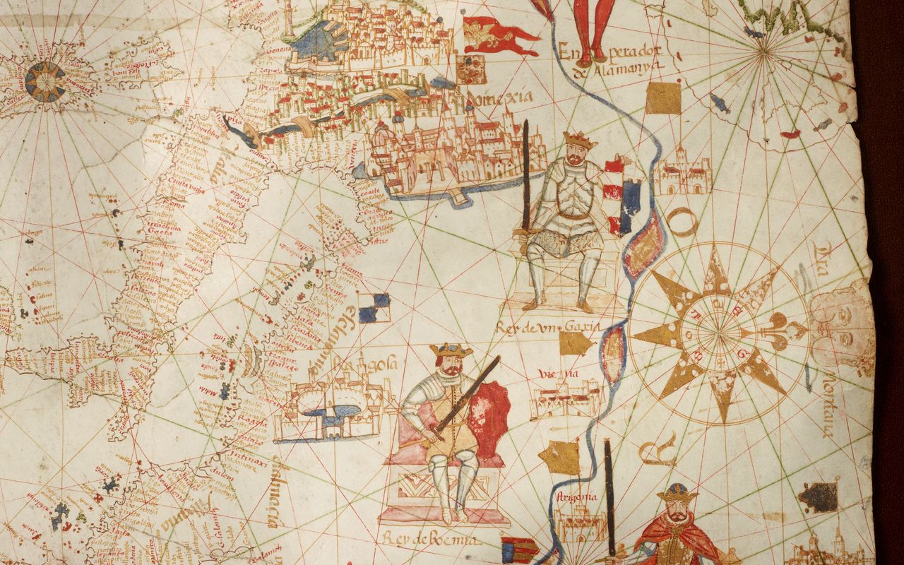
Contents: Portolan chart of the Mediterranean, the Black Sea, the coasts of western Europe and N.W. Africa.
Decoration: Extensive decoration with depictions of Kings and other rulers, animals, etc.
Provenance 1900-1900: Thomas Glazebrook Rylands (1818-1900) bequest (1900): Rylands catalogue, pages 16-17.
Published citations: Ferrar, Michael (2020), Cartography Unchained, "ChLUL/1" https://www.cartographyunchained.com/chlul1/ [retrieved 10 November 2020]
Woodward, David (2007), 'Cartography in the English Renaissance', in D. Woodward, ed., History of Cartography, vol.3/1, Chicago: University of Chicago Press, Appendix 7.1 UKLi1 --- Anonymous (Catalan) chart [16th C} ref MS.F.4.17 (page 254) by Corradino Astengo.
1962: unpublished note by R.A. Skelton (1906-1970) "undoubtedly Majorcan, and probably by a member of the Oliva (Olives) or Prunes families." with further MS references.
1925: Brief description and reduced reproduction in The Studio, (1925), v.89, pages 258-259.
Catalogue description: Sampson, John (1900), A catalogue of the books bequeathed by the late Thomas Glazebrook Rylands to the Library of University College Liverpool, Liverpool: University Press.