Skip to main contentResource added 
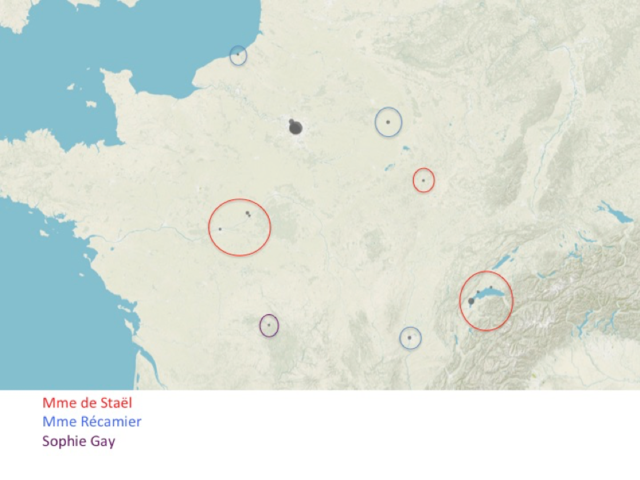

Map of 137 nineteenth-century salons in France
19th-Century Networks. Black dots indicate salons, sized by frequency of occurrence at that location. Salons are circled according to host: Mme. de Staël (red), Mme. Récamier (blue), and Sophie Gay (purple) are circled. The largest black dots, not circled, are the Paris salons.
Comments
to view and add comments.
Annotations
No one has annotated a text with this resource yet.
- typeImage
- created on
- file formatpng
- file size712 kB
- copyright statusIn Copyright
- creatorMelanie Conroy
- rightsCC BY-NC
- rights holderMelanie Conroy