Skip to main contentResource added 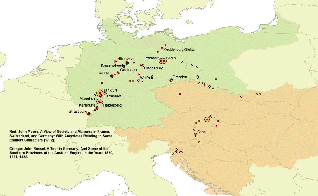


Map of cities along routes in Moore and Russel
Map of cities along routes in John Moore’s A View of society and manners in France, Switzerland, and Germany, with anecdotes relating to some eminent characters (London, Strahan & Cadell, 1783) (red; the map indicates the year in which the trip took place: 1772); and John Russel’s A Tour in Germany (orange). Size indicates the number of times a city is mentioned.
Comments
to view and add comments.
Annotations
No one has annotated a text with this resource yet.
- typeImage
- created on
- file formatjpeg
- file size83 kB
- copyright statusIn Copyright
- creatorKarin Baumgartner
- rightsCC BY-NC
- rights holderKarin Baumgartner